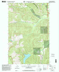
1997 Map of Spar Lake
USGS Topo · Published 2000About this map
Kootenai National Forest and Kaniksu National Forest converge in this high-altitude corner of Lincoln County, dominated by the waters of Spar Lake. The landscape is defined by its dramatic hydrology, with Keeler Creek and its many branches—including the North Fork and South Fork—draining the steep slopes of Keeler Mountain and Grouse Mountain. The 1990s imagery recorded here shows a wilderness managed for both natural resources and recreation, featuring several mines and gravel pits alongside alpine landmarks like Grouse Lake and Spruce Lake. A substation and a network of Forest Service roads at the southern edge of the quadrangle indicate the intersection of utility infrastructure and the timber economy near the East Fork Bull River. Genealogists and historians will find interest in the precisely mapped peaks, such as Stanley Mountain and Pony Mountain, which serve as permanent reference points in this changing forest environment.
Find a feature on this map
38 named features on this map. Tap any name to fly to it.
Don’t see what you’re looking for? This feature index may not catch every label — zoom into the map to look around manually.
Map Details
Editions of this 1997 Spar Lake Map
This is the sole edition of this map. No revisions or reprints were ever made.
Other maps of this area

1911 · Priest Lake
USGS Topo · 1:250,000

1913 · Priest Lake
USGS Topo · 1:250,000

1920 · Libby
USGS Topo · 1:125,000

1930 · Libby
USGS Topo · 1:125,000

1932 · Libby
USGS Topo · 1:125,000

1951 · Clark Fork
USGS Topo · 1:62,500

1951 · Mt Pend Oreille
USGS Topo · 1:62,500

1957 · Kalispell
USGS Topo · 1:250,000

1958 · Sandpoint
USGS Topo · 1:250,000

1960 · Kalispell
USGS Topo · 1:250,000