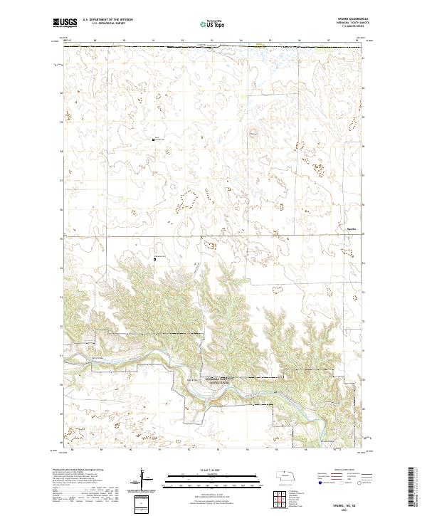
2021 Map of Sparks
USGS Topo · Published 2021About this map
The Niobrara River carves a deep, forested valley through the Sandhills of northern Cherry County, defining the geography of this modern survey. The river corridor is protected as the Niobrara National Scenic River, where the elevation drops significantly from the surrounding plains to the water's edge, creating landmarks like Smith Falls and Berry Falls. In the uplands to the north, the small settlement of Sparks sits near the intersection of section lines that organize this ranching country. Genealogists and local historians can locate remote burial sites such as Kewanee Cem and Saint Joseph Cem, which remain as markers of the area's rural community. Several river crossings, including Berry Bridge, Allen Bridge, and Brewer Bridge, connect the isolated northern plateaus to the southern reaches across the Niobrara Wild and Scenic River.
Find a feature on this map
22 named features on this map. Tap any name to fly to it.
Don’t see what you’re looking for? This feature index may not catch every label — zoom into the map to look around manually.
Map Details
Editions of this 2021 Sparks Map
This is the sole edition of this map. No revisions or reprints were ever made.
Other maps of this area

1950 · Norden
USGS Topo · 1:62,500

1950 · Sparks
USGS Topo · 1:62,500

1952 · Norden
USGS Topo · 1:62,500

1955 · Martin
USGS Topo · 1:250,000

1957 · Valentine
USGS Topo · 1:250,000

1958 · Martin
USGS Topo · 1:250,000

1959 · Valentine
USGS Topo · 1:250,000

1982 · Hidden Timber SE
USGS Topo · 1:24,000
1982 · Keyapaha
USGS Topo · 1:24,000
1982 · Littleburg
USGS Topo · 1:24,000