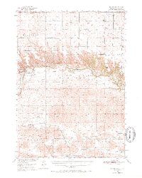
1950 Map of Sparks
USGS Topo · Published 1971About this map
The Niobrara River carves a deep path through northern Nebraska, defining the landscape where the Fort Niobrara National Wildlife Refuge and Fort Niobrara Military Reservation converge. This 1950 survey documents a transitional era for the region's transport and land use, showing the Chicago and North Western railroad line passing through Thatcher, south of the river’s winding course. Distinctive landmarks like Tyler Falls, Smith Falls, and the Cornell Dam site illustrate the river's dynamic geography, while the settlement of Sparks stands as a primary hub in the northeast.
Find a feature on this map
41 named features on this map. Tap any name to fly to it.
Don’t see what you’re looking for? This feature index may not catch every label — zoom into the map to look around manually.
Map Details
Editions of this 1950 Sparks Map
3 editions found
Other maps of this area

1950 · Norden
USGS Topo · 1:62,500

1950 · Sparks
USGS Topo · 1:62,500

1950 · Simeon
USGS Topo · 1:62,500

1950 · Wood Lake
USGS Topo · 1:62,500

1950 · Arabia
USGS Topo · 1:62,500

1950 · Valentine
USGS Topo · 1:62,500

1952 · Norden
USGS Topo · 1:62,500

1955 · Martin
USGS Topo · 1:250,000

1957 · Valentine
USGS Topo · 1:250,000

1958 · Martin
USGS Topo · 1:250,000