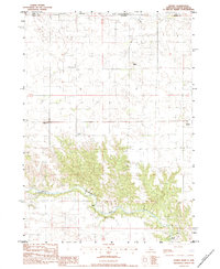
1983 Map of Sparks
USGS Topo · Published 1984About this map
The Niobrara River carves a deep valley through this landscape along the border of Todd and Cherry Counties, where the water meets the dramatic terrain of Flattop. The map captures a transition from the northern reaches of the Rosebud Indian Res in South Dakota down into the Nebraska sandhills. This survey illustrates the rural infrastructure of the early 1980s, highlighting river crossings such as Berry Bridge, Allen Bridge, and Brewer Bridge. Local social centers are anchored by the Kewanee community, featuring the Kewanee Sch, Kewanee Cem, and the nearby St Joseph Cem. To the east, the small settlement of Sparks sits near the river's edge, while the hydraulic importance of the waterway is noted at the Gaging Station and the landmark Smith Falls.
Find a feature on this map
16 named features on this map. Tap any name to fly to it.
Don’t see what you’re looking for? This feature index may not catch every label — zoom into the map to look around manually.
Map Details
Editions of this 1983 Sparks Map
This is the sole edition of this map. No revisions or reprints were ever made.
Other maps of this area

1950 · Norden
USGS Topo · 1:62,500

1950 · Sparks
USGS Topo · 1:62,500

1952 · Norden
USGS Topo · 1:62,500

1955 · Martin
USGS Topo · 1:250,000

1957 · Valentine
USGS Topo · 1:250,000

1958 · Martin
USGS Topo · 1:250,000

1959 · Valentine
USGS Topo · 1:250,000

1982 · Hidden Timber SE
USGS Topo · 1:24,000
1982 · Keyapaha
USGS Topo · 1:24,000
1982 · Littleburg
USGS Topo · 1:24,000