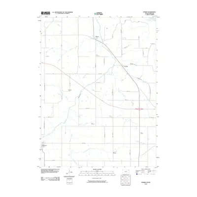
2009 Map of Sparks
USGS Topo · Published 2009About this map
The Wolf River winds through the heart of this Doniphan County landscape, defining the topography of an area dominated by agricultural sections and small rural settlements. Small communities like Sparks and Fanning serve as local anchors, while the historic burial grounds of Iola Cemetery, Fanning Cemetery, and Wolf River Cemetery provide essential touchpoints for genealogical research in this corner of Northeast Kansas.
Find a feature on this map
53 named features on this map. Tap any name to fly to it.
Don’t see what you’re looking for? This feature index may not catch every label — zoom into the map to look around manually.
Map Details
Editions of this 2009 Sparks Map
This is the sole edition of this map. No revisions or reprints were ever made.
Other maps of this area

1885 · Atchison
USGS Topo · 1:125,000

1888 · Atchison
USGS Topo · 1:125,000

1893 · Atchison
USGS Topo · 1:125,000

1926 · Atchison
USGS Topo · 1:62,500

1926 · Oregon
USGS Topo · 1:62,500

1950 · Kansas City
USGS Topo · 1:250,000

1954 · Kansas City
USGS Topo · 1:250,000

1956 · Kansas City
USGS Topo · 1:250,000
1959 · Oregon
USGS Topo · 1:24,000
1959 · White Cloud
USGS Topo · 1:24,000