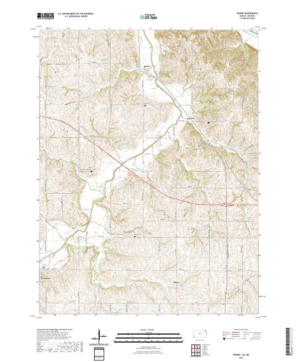
2022 Map of Sparks
USGS Topo · Published 2022About this map
The Wolf River meanders across this northeast Kansas landscape, carving a valley between the settlements of Sparks and Severance. This area is defined by its deep agricultural roots and a dense network of sectional roads, such as Elgin Rd and Eminence Rd, which connect small communities like Fanning and Moray. The distribution of burial grounds across the township—including Iola Cem, Fanning Cem, Burrell Cem, and Wolf River Cem—provides a significant geographic record for genealogists researching the families of Doniphan County. Distinctive terrain features like Half Mound rise above the surrounding creek systems, which include Mission Cr, Kenney Cr, and Pennell Cr. The map captures the enduring rural character of the region, where the grid of county roads remains largely intact around established farmsteads and the historic bypass of Kennekuk Rd.
Find a feature on this map
52 named features on this map. Tap any name to fly to it.
Don’t see what you’re looking for? This feature index may not catch every label — zoom into the map to look around manually.
Map Details
Editions of this 2022 Sparks Map
This is the sole edition of this map. No revisions or reprints were ever made.
Other maps of this area

1885 · Atchison
USGS Topo · 1:125,000

1888 · Atchison
USGS Topo · 1:125,000

1893 · Atchison
USGS Topo · 1:125,000

1926 · Atchison
USGS Topo · 1:62,500

1926 · Oregon
USGS Topo · 1:62,500

1950 · Kansas City
USGS Topo · 1:250,000

1954 · Kansas City
USGS Topo · 1:250,000

1956 · Kansas City
USGS Topo · 1:250,000
1959 · Oregon
USGS Topo · 1:24,000
1959 · White Cloud
USGS Topo · 1:24,000