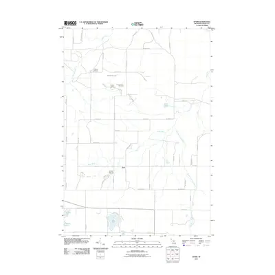
2011 Map of Sparr
USGS Topo · Published 2011About this map
Sparr serves as the central hub of this northern Michigan landscape, situated at the intersection of Sparr Rd and Marquardt Rd. The area is defined by the headwaters and winding courses of several significant waterways, including the Sturgeon River in the northwest and the Pigeon River system that snakes through the central and eastern portions. A distinct shift toward recreational land use is evident in the northern sections, where the Treetops Resort Ski Area and a complex of specialized courses like the Treetops Signature Golf Course and Threetops Golf Course occupy the terrain near Winnie Hill Rd. To the south, the landscape is dotted with prominent bodies of water including Big Lake, Kassuba Lake, and Lake Fifteen, suggesting a region shaped by both its glacial hydrology and its modern evolution into a destination for outdoor sports and seasonal residency.
Find a feature on this map
53 named features on this map. Tap any name to fly to it.
Don’t see what you’re looking for? This feature index may not catch every label — zoom into the map to look around manually.
Map Details
Editions of this 2011 Sparr Map
This is the sole edition of this map. No revisions or reprints were ever made.
Other maps of this area

1949 · Lewiston
USGS Topo · 1:62,500

1949 · Otsego Lake
USGS Topo · 1:62,500

1950 · Johannesburg
USGS Topo · 1:24,000

1950 · Turtle Lake
USGS Topo · 1:24,000

1951 · Turtle Lake
USGS Topo · 1:24,000

1951 · Otsego Lake
USGS Topo · 1:24,000

1951 · Johannesburg
USGS Topo · 1:24,000

1954 · Gaylord
USGS Topo · 1:62,500

1954 · Hetherton
USGS Topo · 1:62,500

1954 · Traverse City
USGS Topo · 1:250,000
Featured Places
- Chester Township, MI
- Corwith Township, MI
- Dover Township, MI
- Bagley Township, MI
- Livingston Township, MI