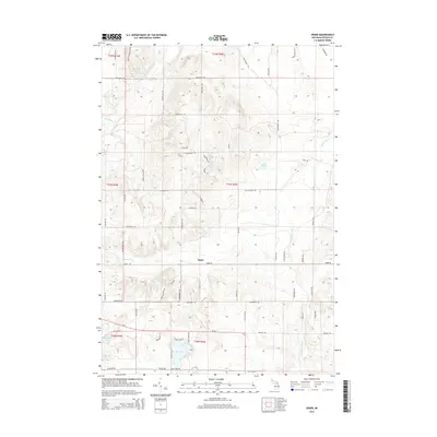
2014 Map of Sparr
USGS Topo · Published 2014About this map
The settlement of Sparr serves as the central point for this northern Michigan landscape, situated at the junction of Sparr Rd and Dover Rd. The area is defined by its complex glacial topography and abundant water features, including the southward-flowing Sturgeon River in the north and the headwaters of the Pigeon River. Significant bodies of water such as Big Lake, Lake Fifteen, and Kassuba Lake are scattered across the terrain, reflecting the region's character as a primary recreational and natural resource area in Otsego County. A dense network of local routes like Whitmarsh Rd, Marquardt Rd, and Jackson Hill Rd connects rural homesteads and wooded tracts, while the S Br Pigeon River winds through the eastern sections, illustrating the intricate drainage patterns of the high plains.
Find a feature on this map
62 named features on this map. Tap any name to fly to it.
Don’t see what you’re looking for? This feature index may not catch every label — zoom into the map to look around manually.
Map Details
Editions of this 2014 Sparr Map
This is the sole edition of this map. No revisions or reprints were ever made.
Other maps of this area

1949 · Lewiston
USGS Topo · 1:62,500

1949 · Otsego Lake
USGS Topo · 1:62,500

1950 · Johannesburg
USGS Topo · 1:24,000

1950 · Turtle Lake
USGS Topo · 1:24,000

1951 · Turtle Lake
USGS Topo · 1:24,000

1951 · Otsego Lake
USGS Topo · 1:24,000

1951 · Johannesburg
USGS Topo · 1:24,000

1954 · Gaylord
USGS Topo · 1:62,500

1954 · Hetherton
USGS Topo · 1:62,500

1954 · Traverse City
USGS Topo · 1:250,000
Featured Places
- Chester Township, MI
- Corwith Township, MI
- Dover Township, MI
- Bagley Township, MI
- Livingston Township, MI