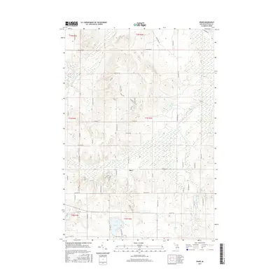
2017 Map of Sparr
USGS Topo · Published 2017About this map
Sparr serves as the central settlement point in this section of Otsego County, where the Upper Peninsula's hydrology begins to take shape through the headwaters of several significant drainage systems. The landscape is defined by the winding course of the Pigeon River and its South Branch, which cut through a terrain of glacial depressions and ridges such as Alpine Ridge and Midway Pass. To the south, larger bodies of water including Big Lake and Kassuba Lake dominate the geography, while Lake Fifteen sits isolated in the central-east. The road network, comprising local routes like Whitmarsh Rd and Seymore Rd, follows the section lines of the Public Land Survey System, revealing a transition from agricultural plots to the more densely wooded wetlands characteristic of the northern Michigan interior.
Find a feature on this map
59 named features on this map. Tap any name to fly to it.
Don’t see what you’re looking for? This feature index may not catch every label — zoom into the map to look around manually.
Map Details
Editions of this 2017 Sparr Map
This is the sole edition of this map. No revisions or reprints were ever made.
Other maps of this area

1949 · Lewiston
USGS Topo · 1:62,500

1949 · Otsego Lake
USGS Topo · 1:62,500

1950 · Johannesburg
USGS Topo · 1:24,000

1950 · Turtle Lake
USGS Topo · 1:24,000

1951 · Turtle Lake
USGS Topo · 1:24,000

1951 · Otsego Lake
USGS Topo · 1:24,000

1951 · Johannesburg
USGS Topo · 1:24,000

1954 · Gaylord
USGS Topo · 1:62,500

1954 · Hetherton
USGS Topo · 1:62,500

1954 · Traverse City
USGS Topo · 1:250,000
Featured Places
- Chester Township, MI
- Corwith Township, MI
- Dover Township, MI
- Bagley Township, MI
- Livingston Township, MI