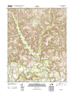
2013 Map of Sparta
USGS Topo · Published 2013About this map
The Mattaponi River meanders through this landscape in King and Queen County, defining a region where small crossroads communities and historic water features anchor the local geography. The area's agricultural and industrial legacy is visible in landmarks such as Jiles Millpond near Sparta and Byrds Millpond to the east. These ponds, along with the extensive King and Queen Swamp and Root Swamp, indicate a low-lying terrain shaped by the many tributaries feeding the river system, including Maracossic Creek and Boiler Run.
Find a feature on this map
60 named features on this map. Tap any name to fly to it.
Don’t see what you’re looking for? This feature index may not catch every label — zoom into the map to look around manually.
Map Details
Editions of this 2013 Sparta Map
This is the sole edition of this map. No revisions or reprints were ever made.
Other maps of this area

1889 · Fredericksburg
USGS Topo · 1:125,000

1892 · Fredericksburg
USGS Topo · 1:125,000

1894 · Fredericksburg
USGS Topo · 1:125,000

1918 · Doswell
USGS Topo · 1:62,500

1918 · Aylett
USGS Topo · 1:62,500

1933 · Aylett
USGS Topo · 1:62,500

1942 · Bowling Green
USGS Topo · 1:31,680

1942 · Upper Zion
USGS Topo · 1:31,680

1942 · Occupacia
USGS Topo · 1:31,680

1943 · Richmond
USGS Topo · 1:250,000