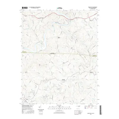
2016 Map of Sparta East
USGS Topo · Published 2016About this map
Edwards Crossroads and Blevins Crossroads anchor the high-country landscape of the Blue Ridge, where the winding Little River and New River carve through the borderlands between North Carolina and Virginia. The terrain is defined by prominent peaks like Bald Knob and Doughton Mtn, with a network of country roads such as Old Baywood Rd and Pleasant Grove Rd connecting rural settlements. Near the town of Sparta, the map reveals a history of local community and industry, including the Zion Cem and the Old Quarry Rd leading toward the river. This survey captures a moment in the 2010s where modern thoroughfares like Grayson Pkwy overlie a traditional settlement pattern of family-named landmarks and mountain gaps, providing a detailed look at the geography of Alleghany County.
Find a feature on this map
125 named features on this map. Tap any name to fly to it.
Don’t see what you’re looking for? This feature index may not catch every label — zoom into the map to look around manually.
Map Details
Editions of this 2016 Sparta East Map
This is the sole edition of this map. No revisions or reprints were ever made.
Other maps of this area

1889 · Hillsville
USGS Topo · 1:125,000

1889 · Wytheville
USGS Topo · 1:125,000

1889 · Wilkesboro
USGS Topo · 1:125,000

1891 · Wilkesboro
USGS Topo · 1:125,000

1891 · Yadkinville
USGS Topo · 1:125,000

1892 · Hillsville
USGS Topo · 1:125,000

1892 · Wytheville
USGS Topo · 1:125,000

1893 · Yadkinville
USGS Topo · 1:125,000

1896 · Hillsville
USGS Topo · 1:125,000

1930 · Independence
USGS Topo · 1:48,000