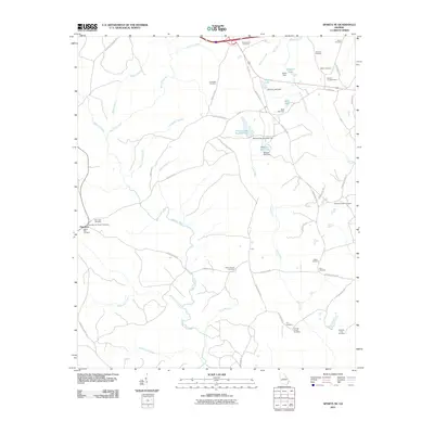
2011 Map of Sparta NE
USGS Topo · Published 2011About this map
The settlement of Powelton anchors the western edge of this landscape, a place marked by deep family roots and a network of rural roads. Genealogists find significant value here, as the map identifies numerous burial sites including the Henry-Burnley Family Cemetery, Battle-Cato Cemetery, and the New Hope Cemetery. These small family and church plots are scattered across a terrain defined by the winding course of the Ogeechee River and its many tributaries, such as Potato Hill Branch and Battle Branch.
Find a feature on this map
64 named features on this map. Tap any name to fly to it.
Don’t see what you’re looking for? This feature index may not catch every label — zoom into the map to look around manually.
Map Details
Editions of this 2011 Sparta NE Map
This is the sole edition of this map. No revisions or reprints were ever made.
Other maps of this area

1906 · Crawfordville
USGS Topo · 1:125,000

1953 · Athens
USGS Topo · 1:250,000

1958 · Athens
USGS Topo · 1:250,000

1959 · Athens
USGS Topo · 1:250,000

1963 · Athens
USGS Topo · 1:250,000

1966 · Crawfordville
USGS Topo · 1:24,000

1971 · Beall Springs
USGS Topo · 1:24,000

1972 · Sharon
USGS Topo · 1:24,000

1972 · Sparta NW
USGS Topo · 1:24,000
1972 · Cadley
USGS Topo · 1:24,000