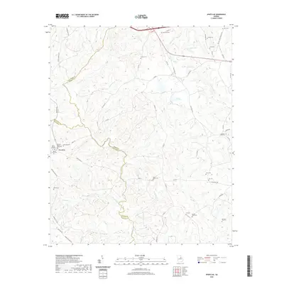
2020 Map of Sparta NE
USGS Topo · Published 2020About this map
The Ogeechee River and its upper tributaries define this landscape at the junction of Hancock, Warren, and Taliaferro Counties. The historic settlement of Powelton serves as a focal point for the western portion of the map, anchored by the Powelton Baptist Church and a cluster of family burial grounds including Burnley Family Cemetery and Battle-Cato Cemetery. The terrain is characterized by a dense network of watercourses such as Beaverdam Creek and Long Creek that drain into the Ogeechee, reflecting a rural Georgia community defined by its topography and ancestral lineages. Dozens of small cemeteries are scattered across the quadrangle, from Crenshaw Cemetery in the north to the Ephraim Ivey Cemetery in the southeast, offering significant detail for genealogists and local historians tracking early families near Shivers Lake.
Find a feature on this map
67 named features on this map. Tap any name to fly to it.
Don’t see what you’re looking for? This feature index may not catch every label — zoom into the map to look around manually.
Map Details
Editions of this 2020 Sparta NE Map
This is the sole edition of this map. No revisions or reprints were ever made.
Other maps of this area

1906 · Crawfordville
USGS Topo · 1:125,000

1953 · Athens
USGS Topo · 1:250,000

1958 · Athens
USGS Topo · 1:250,000

1959 · Athens
USGS Topo · 1:250,000

1963 · Athens
USGS Topo · 1:250,000

1966 · Crawfordville
USGS Topo · 1:24,000

1971 · Beall Springs
USGS Topo · 1:24,000

1972 · Sharon
USGS Topo · 1:24,000

1972 · Sparta NW
USGS Topo · 1:24,000
1972 · Cadley
USGS Topo · 1:24,000