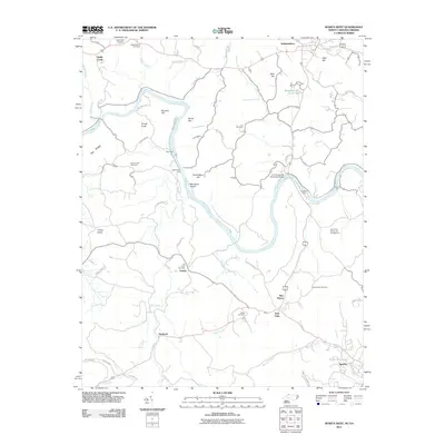
2011 Map of Sparta West
USGS Topo · Published 2011About this map
The New River winds through this North Carolina-Virginia borderland, defining a landscape of sharp ridges and deep valleys. In the early 21st century, the river remains a central artery for the region, connecting historical crossing points like Doughton Ford and Spurlin Ford with modern infrastructure like the R A Doughton Memorial Bridge. The mapping of these fords alongside the New River Canoe and Campground highlights the enduring role of the waterway, transitioning from an essential travel route for early settlers to a focal point for recreation and local heritage.
Find a feature on this map
62 named features on this map. Tap any name to fly to it.
Don’t see what you’re looking for? This feature index may not catch every label — zoom into the map to look around manually.
Map Details
Editions of this 2011 Sparta West Map
This is the sole edition of this map. No revisions or reprints were ever made.
Other maps of this area

1889 · Wytheville
USGS Topo · 1:125,000

1889 · Wilkesboro
USGS Topo · 1:125,000

1891 · Wilkesboro
USGS Topo · 1:125,000

1892 · Wytheville
USGS Topo · 1:125,000

1930 · Independence
USGS Topo · 1:48,000

1933 · Independence
USGS Topo · 1:62,500

1935 · Mouth of Wilson
USGS Topo · 1:48,000

1935 · Middle Fox Creek
USGS Topo · 1:24,000

1940 · Mouth of Wilson
USGS Topo · 1:62,500

1953 · Winston-Salem
USGS Topo · 1:250,000