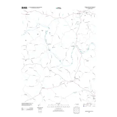
2013 Map of Sparta West
USGS Topo · Published 2013About this map
The New River meanders through the heart of this North Carolina and Virginia borderland, defining a landscape shaped by river crossings and high ridge points. For local historians, the presence of several named river crossings, including Ham Ford, Penitentiary Ford, Doughton Ford, and Spurlin Ford, indicates the long-standing importance of the waterway as a thoroughfare before modern bridges dominated. In the north, the community of Independence sits near the river's path, while the southern reaches show the town of Sparta emerging near Bledsoe Cr. Notable elevation markers like Penitentiary Hill, Turkey Knob, and Bald Hill offer a view into the varied topography that separates small settlements such as Amelia, Stratford, and Twin Oaks. The survey also marks key infrastructure and recreation points, from Maxwell Airport to the New River Canoe and Campground, reflecting the transition from traditional river-crossing culture to contemporary travel and leisure.
Find a feature on this map
140 named features on this map. Tap any name to fly to it.
Don’t see what you’re looking for? This feature index may not catch every label — zoom into the map to look around manually.
Map Details
Editions of this 2013 Sparta West Map
This is the sole edition of this map. No revisions or reprints were ever made.
Other maps of this area

1889 · Wytheville
USGS Topo · 1:125,000

1889 · Wilkesboro
USGS Topo · 1:125,000

1891 · Wilkesboro
USGS Topo · 1:125,000

1892 · Wytheville
USGS Topo · 1:125,000

1930 · Independence
USGS Topo · 1:48,000

1933 · Independence
USGS Topo · 1:62,500

1935 · Mouth of Wilson
USGS Topo · 1:48,000

1935 · Middle Fox Creek
USGS Topo · 1:24,000

1940 · Mouth of Wilson
USGS Topo · 1:62,500

1953 · Winston-Salem
USGS Topo · 1:250,000