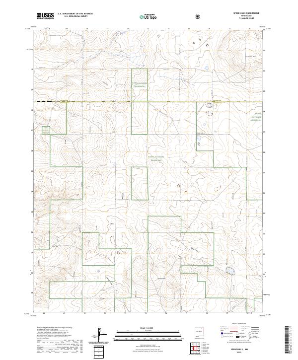
2023 Map of Spear Hills
USGS Topo · Published 2023About this map
Kiowa National Grassland dominates this high-plains landscape, which straddles the border of Colfax and Harding counties. The terrain is defined by a series of intermittent drainages including Alex Draw, Hubsch Draw, and Spear Draw, which carve through the plateau toward the namesake Spear Hills in the southern portion of the quadrangle. High points such as Chateau Hill overlook a sparse network of ranching roads, reflecting the open-range character of this part of northeastern New Mexico. This survey by the U.S. Geological Survey captures the modern extent of federally managed grasslands alongside established rural infrastructure like Shaw Ranch Rd and Brockman Rd, illustrating the enduring ranching economy and conserved prairie environment in this section of the High Plains.
Find a feature on this map
24 named features on this map. Tap any name to fly to it.
Don’t see what you’re looking for? This feature index may not catch every label — zoom into the map to look around manually.
Map Details
Editions of this 2023 Spear Hills Map
This is the sole edition of this map. No revisions or reprints were ever made.
Other maps of this area

1954 · Raton
USGS Topo · 1:250,000

1958 · Raton
USGS Topo · 1:250,000

1965 · Abbott
USGS Topo · 1:24,000

1971 · Abbott Lake
USGS Topo · 1:24,000

1972 · Mills West
USGS Topo · 1:24,000
1974 · Kansas Valley
USGS Topo · 1:24,000

1974 · Farley
USGS Topo · 1:24,000
1974 · Mills East
USGS Topo · 1:24,000

1974 · Spear Hills
USGS Topo · 1:24,000
1974 · Divine Lake
USGS Topo · 1:24,000