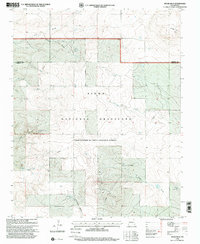
1998 Map of Spear Hills
USGS Topo · Published 2001About this map
The Kiowa National Grassland dominates this high-plains landscape, crossing the boundary between Colfax and Harding counties. This arid territory is defined by its sophisticated water management infrastructure, evidenced by numerous named sources like Tarpley Well, Bauler Well, and Franks Place Well. These features were vital for maintaining livestock and settlement in a region where surface water is seasonal and scarce.
Find a feature on this map
22 named features on this map. Tap any name to fly to it.
Don’t see what you’re looking for? This feature index may not catch every label — zoom into the map to look around manually.
Map Details
Editions of this 1998 Spear Hills Map
This is the sole edition of this map. No revisions or reprints were ever made.
Other maps of this area

1954 · Raton
USGS Topo · 1:250,000

1958 · Raton
USGS Topo · 1:250,000

1965 · Abbott
USGS Topo · 1:24,000

1971 · Abbott Lake
USGS Topo · 1:24,000

1972 · Mills West
USGS Topo · 1:24,000
1974 · Kansas Valley
USGS Topo · 1:24,000

1974 · Farley
USGS Topo · 1:24,000
1974 · Mills East
USGS Topo · 1:24,000

1974 · Spear Hills
USGS Topo · 1:24,000
1974 · Divine Lake
USGS Topo · 1:24,000