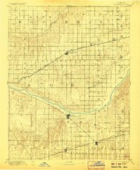
1894 Map of Spearville
USGS Topo · Published 1906About this map
The Arkansas River carves a diagonal path through this late-nineteenth-century landscape, serving as a primary geographic anchor for southern Ford County. During this era of rapid Western expansion, the region's development was dictated by competing rail lines that bridged the prairie. The Atchison Topeka and Santa Fe Railroad cuts across the northern half of the sheet, fostering growth in settlements like Spearville, Offerle, and Wright. To the south, the Chicago Kansas and Nebraska Railroad supports a separate string of frontier outposts including Kingsdown and Bucklin. The map reveals a highly structured grid system of townships such as Sodville and Wheatland, illustrating the transition from open range to a formalized agricultural society. Numerous drainage systems, including Saw Log Creek and Mulberry Creek, provide a detailed look at the local hydrology that supported these early Kansas communities.
Find a feature on this map
37 named features on this map. Tap any name to fly to it.
Don’t see what you’re looking for? This feature index may not catch every label — zoom into the map to look around manually.
Map Details
Editions of this 1894 Spearville Map
4 editions found
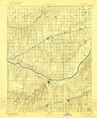
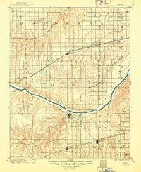
Other maps of this area

1889 · Larned
USGS Topo · 1:125,000

1889 · Kinsley
USGS Topo · 1:125,000

1891 · Larned
USGS Topo · 1:125,000

1892 · Ness
USGS Topo · 1:125,000

1892 · Kinsley
USGS Topo · 1:125,000

1892 · Meade
USGS Topo · 1:125,000

1892 · Dodge
USGS Topo · 1:125,000

1892 · Spearville
USGS Topo · 1:125,000

1892 · Coldwater
USGS Topo · 1:125,000

1894 · Spearville
USGS Topo · 1:125,000