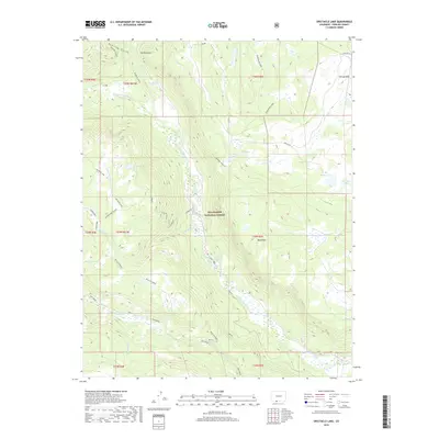
2019 Map of Spectacle Lake
USGS Topo · Published 2019About this map
Spectacle Lake and the high-altitude hydrology of the Rio Grande National Forest define this 2019 survey of the San Juan Mountains. The landscape is characterized by a complex network of glacial basins and drainage systems, where the S Fork Conejos River and the main Conejos River carve through the southern Colorado backcountry. This map reveals a terrain of sharp elevations, featuring prominent landmarks like The Pinnacles and Black Mtn. Notable for its many high-country water bodies, the area includes La Grulla Lake, Lily Lake, and the wetland environments of the Chicago Bogs. The inclusion of the Alverjones Cutoff and various forest service routes indicates the vital management of this timber and recreation land. Historical land use is suggested by the vast Valle Victoria and the alpine grazing areas of Second Meadows.
Find a feature on this map
42 named features on this map. Tap any name to fly to it.
Don’t see what you’re looking for? This feature index may not catch every label — zoom into the map to look around manually.
Map Details
Editions of this 2019 Spectacle Lake Map
This is the sole edition of this map. No revisions or reprints were ever made.
Other maps of this area

1913 · Summitville
USGS Topo · 1:125,000

1915 · Summitville
USGS Topo · 1:125,000

1922 · Conejos
USGS Topo · 1:125,000

1945 · Durango
USGS Topo · 1:250,000

1953 · Durango
USGS Topo · 1:250,000

1954 · Durango
USGS Topo · 1:250,000

1957 · Chama Peak
USGS Topo · 1:62,500

1961 · Durango
USGS Topo · 1:250,000

1963 · Durango
USGS Topo · 1:250,000

1966 · Durango
USGS Topo · 1:250,000