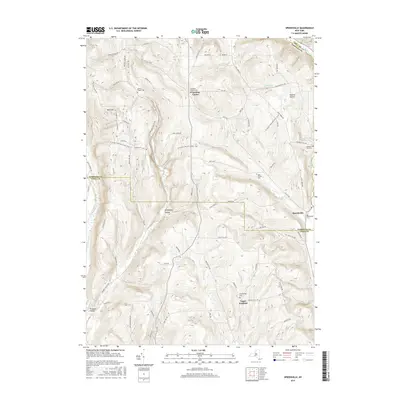
2016 Map of Speedsville
USGS Topo · Published 2016About this map
The boundary between Tompkins County and Tioga County cuts through this rural landscape, anchoring a network of small settlements and family burial grounds in the Southern Tier. At the center of the local community, the village of Speedsville sits near the headwaters of Boyer Creek, while Caroline Center and Upper Fairfield provide further context for the region's scattered residential clusters. The land is defined by prominent elevations like Bald Mountain and the deep incisions of Shindagin Hollow and Rawson Hollow.
Find a feature on this map
71 named features on this map. Tap any name to fly to it.
Don’t see what you’re looking for? This feature index may not catch every label — zoom into the map to look around manually.
Map Details
Editions of this 2016 Speedsville Map
This is the sole edition of this map. No revisions or reprints were ever made.
Other maps of this area

1900 · Dryden
USGS Topo · 1:62,500

1901 · Apalachin
USGS Topo · 1:62,500

1903 · Owego
USGS Topo · 1:62,500

1903 · Harford
USGS Topo · 1:62,500

1904 · Apalachin
USGS Topo · 1:62,500

1906 · Catatonk
USGS Topo · 1:125,000

1949 · Ithaca East
USGS Topo · 1:24,000

1949 · Willseyville
USGS Topo · 1:24,000
1949 · Dryden
USGS Topo · 1:24,000

1949 · Speedsville
USGS Topo · 1:24,000