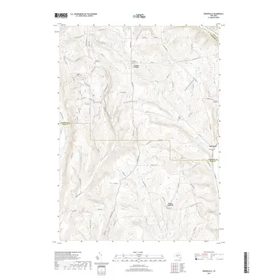
2019 Map of Speedsville
USGS Topo · Published 2019About this map
Speedsville and Caroline Center anchor this rural landscape along the border of Tompkins and Tioga Counties. The terrain is defined by significant elevation changes, notably around Bald Mtn, with a network of creeks like W Br Owego Cr and Doolittle Cr carving through the valleys. The map highlights a rich genealogical record through numerous small burial sites, including the Blair Family Plot and Goodrich Hill Cem. Modern recreation is represented by the N Country National Scenic Trail, which winds across the ridges near Upper Fairfield. The settlement pattern follows a traditional grid of local roads such as Old 76 Rd and Buffalo Rd, illustrating a community where historical hamlets remain distinct amidst protected state lands.
Find a feature on this map
69 named features on this map. Tap any name to fly to it.
Don’t see what you’re looking for? This feature index may not catch every label — zoom into the map to look around manually.
Map Details
Editions of this 2019 Speedsville Map
This is the sole edition of this map. No revisions or reprints were ever made.
Other maps of this area

1900 · Dryden
USGS Topo · 1:62,500

1901 · Apalachin
USGS Topo · 1:62,500

1903 · Owego
USGS Topo · 1:62,500

1903 · Harford
USGS Topo · 1:62,500

1904 · Apalachin
USGS Topo · 1:62,500

1906 · Catatonk
USGS Topo · 1:125,000

1949 · Ithaca East
USGS Topo · 1:24,000

1949 · Willseyville
USGS Topo · 1:24,000
1949 · Dryden
USGS Topo · 1:24,000

1949 · Speedsville
USGS Topo · 1:24,000