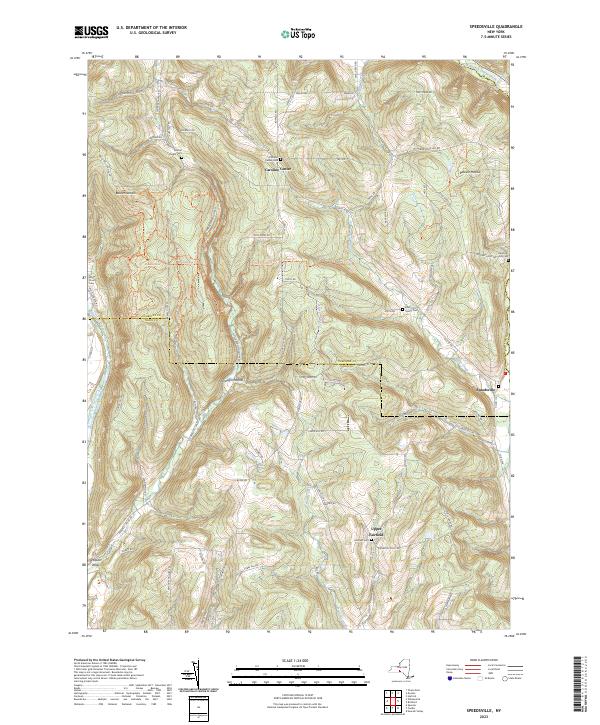
2023 Map of Speedsville
USGS Topo · Published 2023About this map
Speedsville and Caroline Center anchor this 2023 survey of the hilly country straddling the Tompkins Co and Tioga Co line. The landscape is defined by deep incisions like Shindagin Hollow and the flow of West Branch Owego Creek, which historically shaped the placement of farmsteads and travel routes. Genealogists will find a wealth of burial records across this terrain, from the Central Chapel Cem and White Church Cem to the intimate Blair Family Plot. Modern recreation intersects with the historical landscape along the North Country National Scenic Trl, which winds through the central ridges. The map meticulously records numerous local roads, such as Goodrich Hill Rd and Old 76 Rd, which connect the small clusters of Upper Fairfield and Rawson Hollow to the surrounding agricultural and forested lands.
Find a feature on this map
73 named features on this map. Tap any name to fly to it.
Don’t see what you’re looking for? This feature index may not catch every label — zoom into the map to look around manually.
Map Details
Editions of this 2023 Speedsville Map
This is the sole edition of this map. No revisions or reprints were ever made.
Other maps of this area

1900 · Dryden
USGS Topo · 1:62,500

1901 · Apalachin
USGS Topo · 1:62,500

1903 · Owego
USGS Topo · 1:62,500

1903 · Harford
USGS Topo · 1:62,500

1904 · Apalachin
USGS Topo · 1:62,500

1906 · Catatonk
USGS Topo · 1:125,000

1949 · Ithaca East
USGS Topo · 1:24,000

1949 · Willseyville
USGS Topo · 1:24,000
1949 · Dryden
USGS Topo · 1:24,000

1949 · Speedsville
USGS Topo · 1:24,000