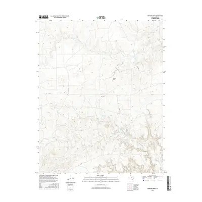
2016 Map of Spencer Draw
USGS Topo · Published 2016About this map
Thompson Estate Lake and Weymouth Middle Lake anchor this 2016 survey of Moore County, where the High Plains landscape is defined by the drainage networks of Spencer Draw and Red Draw. The map details the intricate topography of the Texas Panhandle, showing how water moves through systems like Grapevine Cr and the various branches of the Plum Creek system, including N Plum Cr and S Plum Cr. Local transportation is represented by a grid of rural routes and farm-to-market roads, most notably FM 1913, which traverses the center of the sheet. Named corridors such as Denison Rd, Zofness Rd, and Cig Rd provide specific reference points for researchers tracking land use and property boundaries in this pastoral region north of the Canadian River valley.
Find a feature on this map
12 named features on this map. Tap any name to fly to it.
Don’t see what you’re looking for? This feature index may not catch every label — zoom into the map to look around manually.
Map Details
Editions of this 2016 Spencer Draw Map
This is the sole edition of this map. No revisions or reprints were ever made.
Other maps of this area

1936 · Fourways
USGS Topo · 1:62,500

1939 · Sanford
USGS Topo · 1:62,500

1953 · Marsh
USGS Topo · 1:24,000

1953 · Alibates Ranch
USGS Topo · 1:24,000

1953 · Evans Canyon
USGS Topo · 1:24,000

1953 · Masterson
USGS Topo · 1:24,000

1953 · McDowell Creek
USGS Topo · 1:24,000

1953 · Spencer Draw
USGS Topo · 1:24,000

1954 · Amarillo
USGS Topo · 1:250,000

1958 · Amarillo
USGS Topo · 1:250,000