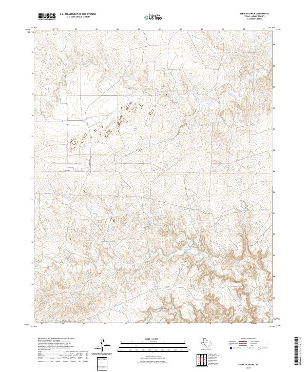
2022 Map of Spencer Draw
USGS Topo · Published 2022About this map
Thompson Estate Lake and Weymouth Middle Lake are prominent water features in this Moore County landscape, situated amid the complex drainage patterns of the Texas Panhandle. The terrain is defined by substantial erosional cuts, most notably Spencer Draw and Red Draw, which channel seasonal runoff through the high plains. A network of rural roads, including FM 1913, Denison Rd, and CIG Rd, provides access across this cattle-country topography. The intricate network of seasonal creek beds, such as N Plum Cr and S Plum Cr, illustrates the hydrological dependency of the region's ranching economy on specific draws and named catchments.
Find a feature on this map
12 named features on this map. Tap any name to fly to it.
Don’t see what you’re looking for? This feature index may not catch every label — zoom into the map to look around manually.
Map Details
Editions of this 2022 Spencer Draw Map
This is the sole edition of this map. No revisions or reprints were ever made.
Other maps of this area

1936 · Fourways
USGS Topo · 1:62,500

1939 · Sanford
USGS Topo · 1:62,500

1953 · Marsh
USGS Topo · 1:24,000

1953 · Alibates Ranch
USGS Topo · 1:24,000

1953 · Evans Canyon
USGS Topo · 1:24,000

1953 · Masterson
USGS Topo · 1:24,000

1953 · McDowell Creek
USGS Topo · 1:24,000

1953 · Spencer Draw
USGS Topo · 1:24,000

1954 · Amarillo
USGS Topo · 1:250,000

1958 · Amarillo
USGS Topo · 1:250,000