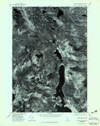
1977 Map of Spencer Lake
USGS Topo · Published 1983About this map
Spencer Lake dominates this orthophotograph, stretching through the center of a heavily forested landscape in Somerset County. Created from aerial photography taken in late 1977, this document offers a photographic record of the Maine wilderness during a period of industrial timber management. The visual data captures the density of the forest canopy and the clearings around Hardwood Mountain and Hedgehog Mountain, providing more texture than a standard line-drawn topographic map. Baker Stream is visible in the southwestern portion of the sheet, winding through the terrain as it feeds into the regional water system. This orthophotoquad is particularly valuable for researchers tracing land-use patterns, logging roads, and the natural drainage of the Maine woods before more recent development or conservation shifts.
Find a feature on this map
4 named features on this map. Tap any name to fly to it.
Don’t see what you’re looking for? This feature index may not catch every label — zoom into the map to look around manually.
Map Details
Editions of this 1977 Spencer Lake Map
This is the sole edition of this map. No revisions or reprints were ever made.
Other maps of this area

1922 · Long Pond
USGS Topo · 1:62,500

1923 · Attean
USGS Topo · 1:62,500

1924 · Long Pond
USGS Topo · 1:62,500

1925 · Pierce Pond
USGS Topo · 1:48,000

1925 · Attean
USGS Topo · 1:62,500

1927 · Pierce Pond
USGS Topo · 1:62,500

1928 · Spencer
USGS Topo · 1:48,000

1932 · Spencer
USGS Topo · 1:62,500

1944 · Long Pond
USGS Topo · 1:62,500

1944 · Pierce Pond
USGS Topo · 1:62,500
Featured Places
- Upper Enchanted Township, ME
- Haynestown Township, ME
- T3 R5 BKP WKR, ME
- Rayton Township, ME
- Bradstreet Township, ME