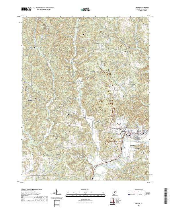
2022 Map of Spencer
USGS Topo · Published 2022About this map
Spencer serves as the seat of Owen County, oriented along the banks of the White River. This map shows a landscape defined by significant elevation changes, with prominent heights like Cooksey Hill, Gaston Hill, and Taylor Hill rising above the river valley. The civic heart of the area is anchored by the Owen County Court House, while the surrounding rural townships are dotted with dozens of family and community burial grounds, including the Saint Walley Cem, Palestine Cem, and Mount Moriah Cem.
Find a feature on this map
154 named features on this map. Tap any name to fly to it.
Don’t see what you’re looking for? This feature index may not catch every label — zoom into the map to look around manually.
Map Details
Editions of this 2022 Spencer Map
This is the sole edition of this map. No revisions or reprints were ever made.
Other maps of this area

1908 · Bloomington
USGS Topo · 1:48,000

1908 · Bloomfield
USGS Topo · 1:62,500

1910 · Bloomington
USGS Topo · 1:62,500

1947 · Gosport
USGS Topo · 1:24,000

1949 · Quincy
USGS Topo · 1:24,000

1950 · Gosport
USGS Topo · 1:24,000

1950 · Arney
USGS Topo · 1:24,000

1953 · Indianapolis
USGS Topo · 1:250,000

1956 · Indianapolis
USGS Topo · 1:250,000

1956 · Cataract
USGS Topo · 1:24,000