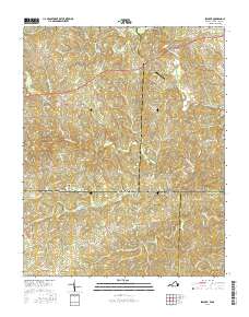
2016 Map of Spencer
USGS Topo · Published 2016About this map
The South Mayo River and North Mayo River converge near the Virginia and North Carolina state line, carving a landscape of winding stream valleys across the border of Patrick and Henry counties in Virginia, and Stokes and Rockingham counties in North Carolina. This rural corridor is defined by small, dispersed settlements like Spencer, Craig, and Amostown, reflecting a long-standing pattern of upland agricultural and timber communities. The namesake Sandy Ridge landform anchors the southern portion of the quadrangle, where the terrain shifts toward the headwaters of Buffalo Cr. Cultural landmarks like Sheppards Mill and the Covington Airport stand alongside family legacy sites such as the Harris Cem and Gibson Cem, illustrating the deep-rooted local history and infrastructure that persists in this Piedmont borderland.
Find a feature on this map
79 named features on this map. Tap any name to fly to it.
Don’t see what you’re looking for? This feature index may not catch every label — zoom into the map to look around manually.
Map Details
Editions of this 2016 Spencer Map
This is the sole edition of this map. No revisions or reprints were ever made.
Other maps of this area

1924 · Martinsville
USGS Topo · 1:48,000

1926 · Martinsville
USGS Topo · 1:62,500

1926 · Critz
USGS Topo · 1:48,000

1927 · Martinsville
USGS Topo · 1:62,500

1928 · Critz
USGS Topo · 1:62,500

1944 · Martinsville
USGS Topo · 1:62,500

1953 · Winston-Salem
USGS Topo · 1:250,000

1953 · Greensboro
USGS Topo · 1:250,000

1954 · Greensboro
USGS Topo · 1:250,000

1955 · Winston-Salem
USGS Topo · 1:250,000