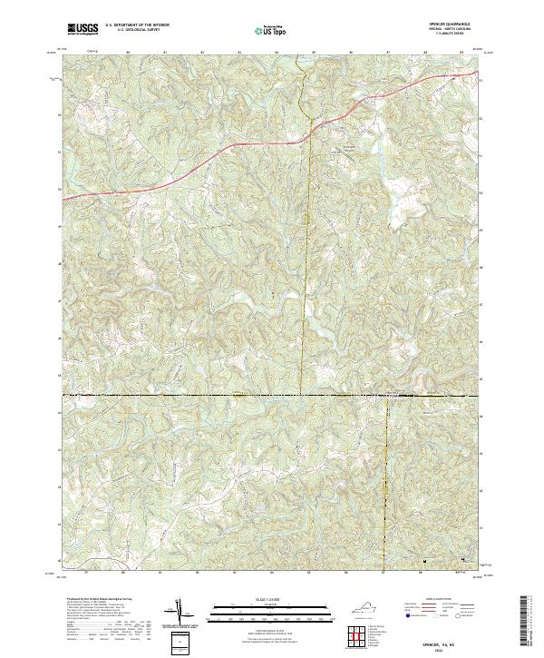
2022 Map of Spencer
USGS Topo · Published 2022About this map
The N Mayo River, North Mayo River, and South Mayo River converge and weave through the borderlands between Virginia and North Carolina, creating a complex drainage network that includes Little Mill Cr and Buffalo Cr. This area is defined by its deep connectivity between rural counties, where legacy transportation routes like the Old Winston Salem Tpke and Dick and Willie Rd cross state lines.
Find a feature on this map
76 named features on this map. Tap any name to fly to it.
Don’t see what you’re looking for? This feature index may not catch every label — zoom into the map to look around manually.
Map Details
Editions of this 2022 Spencer Map
This is the sole edition of this map. No revisions or reprints were ever made.
Other maps of this area

1924 · Martinsville
USGS Topo · 1:48,000

1926 · Martinsville
USGS Topo · 1:62,500

1926 · Critz
USGS Topo · 1:48,000

1927 · Martinsville
USGS Topo · 1:62,500

1928 · Critz
USGS Topo · 1:62,500

1944 · Martinsville
USGS Topo · 1:62,500

1953 · Winston-Salem
USGS Topo · 1:250,000

1953 · Greensboro
USGS Topo · 1:250,000

1954 · Greensboro
USGS Topo · 1:250,000

1955 · Winston-Salem
USGS Topo · 1:250,000