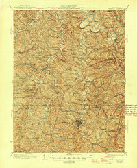
1928 Map of Spencer
USGS Topo · Published 1945About this map
The Spencer quadrangle is defined by the tight, winding valleys of Reedy Creek and the Little Kanawha River, where a dense network of early 20th-century rural life was organized around small neighborhood schools and country churches. The southern terminus of a Baltimore and Ohio Railroad branch line reaches into the heart of the region at Billings Sta and Spencer, facilitating the movement of local timber and goods.
Find a feature on this map
80 named features on this map. Tap any name to fly to it.
Don’t see what you’re looking for? This feature index may not catch every label — zoom into the map to look around manually.
Map Details
Editions of this 1928 Spencer Map
2 editions found

Other maps of this area

1906 · Elizabeth
USGS Topo · 1:62,500

1906 · Belleville
USGS Topo · 1:62,500

1906 · Kenna
USGS Topo · 1:62,500

1906 · Otter
USGS Topo · 1:62,500

1906 · Walton
USGS Topo · 1:62,500

1907 · Kenna
USGS Topo · 1:62,500

1907 · Otter
USGS Topo · 1:62,500

1907 · Harrisville
USGS Topo · 1:62,500

1907 · Arnoldsburg
USGS Topo · 1:62,500

1907 · Spencer
USGS Topo · 1:62,500