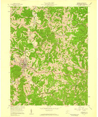
1957 Map of Spencer
USGS Topo · Published 1959About this map
The town of Spencer serves as a bustling central hub in this 1950s study, defined by the convergence of the Baltimore and Ohio RR and a dense network of local roads. The landscape is characterized by its steep, wooded ridges and narrow hollows like Blosser Hollow and Knotts Hollow, with the sprawling grounds of the State Hospital anchoring the south side of town.
Find a feature on this map
84 named features on this map. Tap any name to fly to it.
Don’t see what you’re looking for? This feature index may not catch every label — zoom into the map to look around manually.
Map Details
Editions of this 1957 Spencer Map
3 editions found
Other maps of this area

1906 · Otter
USGS Topo · 1:62,500

1906 · Walton
USGS Topo · 1:62,500

1907 · Otter
USGS Topo · 1:62,500

1907 · Arnoldsburg
USGS Topo · 1:62,500

1907 · Spencer
USGS Topo · 1:62,500

1907 · Walton
USGS Topo · 1:62,500

1925 · Arnoldsburg
USGS Topo · 1:62,500

1927 · Arnoldsburg
USGS Topo · 1:62,500

1928 · Spencer
USGS Topo · 1:62,500

1954 · Charleston
USGS Topo · 1:250,000