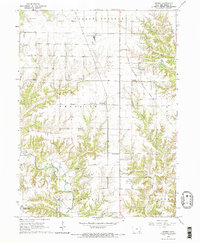
1964 Map of Sperry
USGS Topo · Published 1965About this map
Sperry serves as a central hub in Des Moines County on this mid-1960s survey, situated along the Chicago Rock Island And Pacific railroad. The landscape is defined by the transition from the agricultural tablelands of Yellow Springs and Franklin townships to the deeply incised valleys of Flint Creek and Yellow Spring Creek. These drainage patterns reveal the underlying geology of the region, which supported local industry like the Gypsum Plant and its adjacent Water Tank.
Find a feature on this map
24 named features on this map. Tap any name to fly to it.
Don’t see what you’re looking for? This feature index may not catch every label — zoom into the map to look around manually.
Map Details
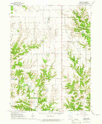
Editions of this 1964 Sperry Map
2 editions found
Other maps of this area

1934 · Burlington
USGS Topo · 1:48,000

1940 · Burlington
USGS Topo · 1:62,500

1946 · Wapello
USGS Topo · 1:62,500

1949 · Wapello
USGS Topo · 1:62,500

1958 · Burlington
USGS Topo · 1:250,000

1958 · Davenport
USGS Topo · 1:250,000

1961 · Burlington
USGS Topo · 1:250,000

1961 · Davenport
USGS Topo · 1:250,000

1962 · Davenport
USGS Topo · 1:250,000

1963 · Burlington
USGS Topo · 1:250,000