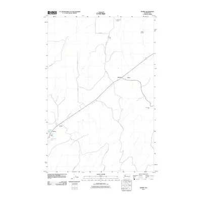
2011 Map of Sperry
USGS Topo · Published 2011About this map
Harder and Sperry anchor this landscape in the southeastern Washington Palouse, showing a network of agricultural outposts and rural infrastructure. The map reveals a highly structured pattern of ranching and farming, evidenced by sites like the Ross Farm, Nanamaker Farm, and the larger Harder Ranch. Transportation and water access appear critical to the area's development, with roads such as Perry Rd and Palmer Rd connecting isolated settlements. In the southwestern corner, Washtucna Lake and Harder Spring provide rare hydrologic features in an otherwise dry, coulee-carved terrain. The presence of Fisher Ranch Airport and railroad junctions at McAdam and Wacota underscores the logistics required to support this remote farming economy in the early 21st century. Collier Coulee cuts through the northeast, illustrating the distinct geological erosion characteristic of the region.
Find a feature on this map
20 named features on this map. Tap any name to fly to it.
Don’t see what you’re looking for? This feature index may not catch every label — zoom into the map to look around manually.
Map Details
Editions of this 2011 Sperry Map
This is the sole edition of this map. No revisions or reprints were ever made.
Other maps of this area

1916 · Connell
USGS Topo · 1:125,000

1918 · Connell
USGS Topo · 1:125,000

1923 · Washtucna
USGS Topo · 1:62,500

1925 · Washtucna
USGS Topo · 1:62,500

1948 · Ayer
USGS Topo · 1:62,500

1950 · Haas
USGS Topo · 1:62,500

1953 · Walla Walla
USGS Topo · 1:250,000

1958 · Walla Walla
USGS Topo · 1:250,000
1970 · Lower Monumental Dam
USGS Topo · 1:24,000

1970 · Lind SE
USGS Topo · 1:24,000