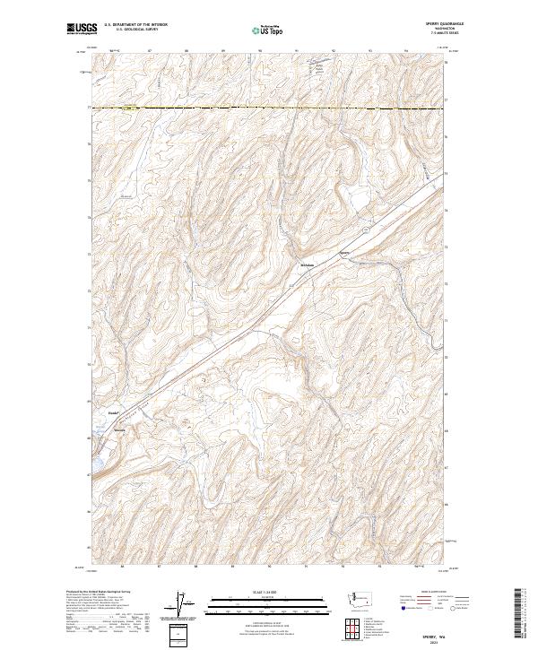
2023 Map of Sperry
USGS Topo · Published 2023About this map
Washtucna Coulee and Skookum Canyon define the topographic character of this portion of the Palouse region, where the Adams and Franklin county line divides the landscape. This modern digital survey illustrates the contemporary connectivity of a historically rail-dependent agricultural corridor. The Columbia Plateau State Park Trl follows a linear path across the terrain, passing through the sites of Sperry, McAdam, and Wacota. These names represent small points of activity along the trail that formerly served the railroad network. The presence of Harder Spring and Fisher Ranch Airport highlights the combination of natural water sources and private aviation that supports modern ranching and farming operations in this high-desert environment.
Find a feature on this map
26 named features on this map. Tap any name to fly to it.
Don’t see what you’re looking for? This feature index may not catch every label — zoom into the map to look around manually.
Map Details
Editions of this 2023 Sperry Map
This is the sole edition of this map. No revisions or reprints were ever made.
Other maps of this area

1916 · Connell
USGS Topo · 1:125,000

1918 · Connell
USGS Topo · 1:125,000

1923 · Washtucna
USGS Topo · 1:62,500

1925 · Washtucna
USGS Topo · 1:62,500

1948 · Ayer
USGS Topo · 1:62,500

1950 · Haas
USGS Topo · 1:62,500

1953 · Walla Walla
USGS Topo · 1:250,000

1958 · Walla Walla
USGS Topo · 1:250,000
1970 · Lower Monumental Dam
USGS Topo · 1:24,000

1970 · Lind SE
USGS Topo · 1:24,000