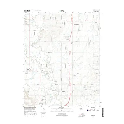
2016 Map of Sperry
USGS Topo · Published 2016About this map
Bird Creek and its many tributaries, including Charley Cr and Delaware Cr, define the drainage patterns of this northern Oklahoma landscape as suburban growth from Tulsa and Owasso moves into the rural hinterlands. The map reveals a high density of small family and community burial grounds, such as Skybuck Cem, Chisholm Cem, and Lord Cem, reflecting the deep-rooted settlement history of the region. Transportation corridors like the Cherokee Expy and N Yale Ave facilitate the expansion of Turley and Sperry, while the meandering course of the creek creates distinctive landforms like Horseshoe Bend. Aviation history is present at Airman Acres Airport, providing a window into the region's private flight infrastructure during the mid-2010s. This survey is particularly useful for genealogists tracking family names through the numerous smaller cemeteries scattered between Skiatook and Collinsville.
Find a feature on this map
117 named features on this map. Tap any name to fly to it.
Don’t see what you’re looking for? This feature index may not catch every label — zoom into the map to look around manually.
Map Details
Editions of this 2016 Sperry Map
This is the sole edition of this map. No revisions or reprints were ever made.
Other maps of this area

1901 · Claremore
USGS Topo · 1:125,000

1912 · Hominy
USGS Topo · 1:125,000

1914 · Claremore
USGS Topo · 1:125,000

1915 · Hominy
USGS Topo · 1:125,000

1916 · Claremore
USGS Topo · 1:125,000

1954 · Tulsa
USGS Topo · 1:250,000

1954 · Tulsa
USGS Topo · 1:24,000

1955 · Sperry
USGS Topo · 1:24,000

1955 · Mingo
USGS Topo · 1:24,000

1955 · Enid
USGS Topo · 1:250,000