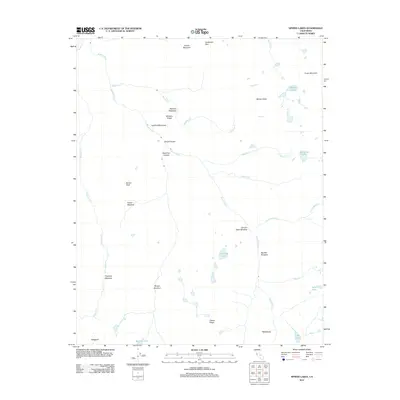
2012 Map of Sphinx Lakes
USGS Topo · Published 2012About this map
Cloud Canyon and Deadman Canyon converge to define the drainage of the Roaring River, a central corridor through this High Sierra landscape. The 2012 survey illustrates a topography of high-altitude basins and meadows, where the namesake Sphinx Lakes sit beneath the high Sphinx Crest and Cross Mountain. The distribution of named meadows, such as Moraine Meadows, Scaffold Meadows, and Big Wet Meadow, suggests a pattern of glacial deposition and seasonal drainage that has shaped the region's wilderness character for generations.
Find a feature on this map
33 named features on this map. Tap any name to fly to it.
Don’t see what you’re looking for? This feature index may not catch every label — zoom into the map to look around manually.
Map Details
Editions of this 2012 Sphinx Lakes Map
This is the sole edition of this map. No revisions or reprints were ever made.
Other maps of this area

1903 · Tehipite
USGS Topo · 1:125,000

1905 · Tehipite
USGS Topo · 1:125,000

1907 · Mt. Whitney
USGS Topo · 1:125,000

1919 · Mt. Whitney
USGS Topo · 1:125,000

1937 · Mt. Whitney
USGS Topo · 1:125,000

1948 · Fresno
USGS Topo · 1:250,000

1953 · Mt. Pinchot
USGS Topo · 1:62,500

1953 · Marion Peak
USGS Topo · 1:62,500

1955 · Fresno
USGS Topo · 1:250,000

1956 · Fresno
USGS Topo · 1:250,000