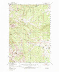
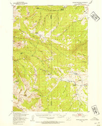
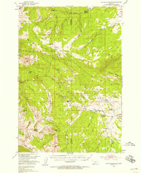
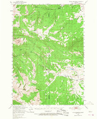
1950 Map of Sphinx Mountain
USGS Topo · Published 1987About this map
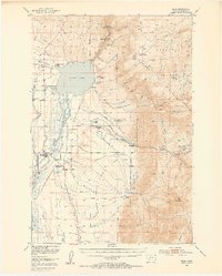
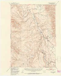
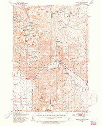
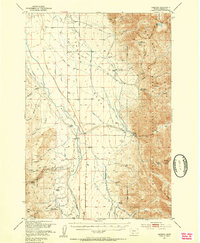
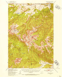
The Madison Range dominates this mid-century survey, defining the rugged boundary between the Gallatin National Forest and Beaverhead National Forest. This high-altitude landscape is characterized by prominent peaks like Sphinx Mtn and Koch Peak, which overlook a network of glaciated basins and drainage systems. The map documents the early infrastructure of the U.S. Forest Service, showing the placement of several outposts such as Big Spring Ranger Sta and Cache Creek Ranger Sta. Along the eastern edge, the transition from mountainous forest to cattle country is evident through established operations like the Michel Ranch and Lazy T 4 Ranch. A detailed network of pack trails, including the Bear Creek Trail and Wapiti Trail, connects these remote drainage basins long before the expansion of modern road systems in the region.
Find a feature on this map
68 named features on this map. Tap any name to fly to it.
Don’t see what you’re looking for? This feature index may not catch every label — zoom into the map to look around manually.
Map Details
Editions of this 1950 Sphinx Mountain Map
4 editions found
Other maps of this area

1888 · Three Forks
USGS Topo · 1:250,000

1894 · Three Forks
USGS Topo · 1:250,000

1895 · Three Forks
USGS Topo · 1:250,000

1947 · Bozeman
USGS Topo · 1:250,000

1948 · Bozeman
USGS Topo · 1:250,000
1949 · Ennis
USGS Topo · 1:62,500
1950 · Cliff Lake
USGS Topo · 1:62,500
1950 · Hebgen Dam
USGS Topo · 1:62,500
1950 · Cameron
USGS Topo · 1:62,500
1950 · Spanish Peaks
USGS Topo · 1:62,500