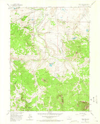
1956 Map of Spicer Peak
USGS Topo · Published 1965About this map
Spicer Peak and the high country of the Rabbit Ears Range define this mid-century look at the border of Jackson and Grand counties. The landscape is a network of ranching homesteads and sophisticated water management systems, where the Continental Divide winds through the southern reaches of the map. Private family holdings such as the Van Valkenburg Ranch and Chas Murphy Ranch are situated near extensive irrigation features like the Koping Ditch and Jordan DITCH, which redirected alpine snowmelt to support high-altitude grazing.
Find a feature on this map
41 named features on this map. Tap any name to fly to it.
Don’t see what you’re looking for? This feature index may not catch every label — zoom into the map to look around manually.
Map Details
Editions of this 1956 Spicer Peak Map
5 editions found

Other maps of this area

1911 · Hahns Peak
USGS Topo · 1:125,000

1913 · Hahns Peak
USGS Topo · 1:125,000

1954 · Craig
USGS Topo · 1:250,000

1955 · Teal Lake
USGS Topo · 1:24,000

1955 · Coalmont
USGS Topo · 1:24,000

1955 · Mac Farlane Reservoir
USGS Topo · 1:24,000

1955 · Mount Ethel
USGS Topo · 1:62,500

1955 · Walden
USGS Topo · 1:62,500

1956 · Rabbit Ears Peak
USGS Topo · 1:24,000

1956 · Lake Agnes
USGS Topo · 1:24,000