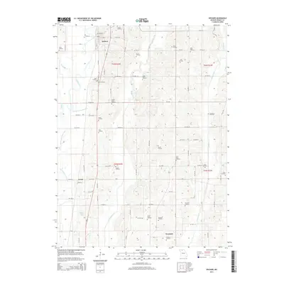
2014 Map of Spickard
USGS Topo · Published 2014About this map
Spickard anchor this rural Grundy County landscape, where the meandering Weldon River and its accompanying Old Channel Weldon River define the local topography. This region is remarkably dense with family and community burial grounds, offering significant value for genealogical research. Notable sites include the James Clark Cemetery, William Clark Cemetery, and the dual North Evans and South Evans locations. The terrain is further etched by numerous tributaries such as Muddy Creek and Owl Branch, which flow toward the southern reaches near Wyandotte. Further west, the small settlement of Tindall sits along the road network near Williams Pond, providing a clear record of the area's twentieth-century rural development and the enduring footprint of its early pioneer families.
Find a feature on this map
71 named features on this map. Tap any name to fly to it.
Don’t see what you’re looking for? This feature index may not catch every label — zoom into the map to look around manually.
Map Details
Editions of this 2014 Spickard Map
This is the sole edition of this map. No revisions or reprints were ever made.
Other maps of this area

1946 · Princeton
USGS Topo · 1:62,500

1946 · Galt
USGS Topo · 1:62,500

1948 · Princeton
USGS Topo · 1:62,500

1948 · Trenton
USGS Topo · 1:62,500

1949 · Galt
USGS Topo · 1:62,500

1954 · Centerville
USGS Topo · 1:250,000

1957 · Centerville
USGS Topo · 1:250,000

1958 · Centerville
USGS Topo · 1:250,000

1964 · Half Rock
USGS Topo · 1:24,000
1981 · Trenton
USGS Topo · 1:100,000