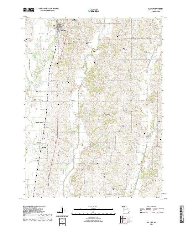
2021 Map of Spickard
USGS Topo · Published 2021About this map
Spickard and Tindall serve as the primary settlement hubs in this part of Grundy County, where the landscape is defined by the winding course of the Weldon River and its accompanying Old Channel Weldon River. The area is notably dense with small, family-named burial grounds, such as James Clark Cem, William Clark Cem, and the North Evans Cem, suggesting a long history of generational land ownership. Water is a central feature of the local geography, with Muddy Creek and Honey Creek carving through the terrain alongside smaller tributaries like Owl Br and Woods Cr. Transport in the region follows a mix of established routes like NW State HWY C and State HWY O, alongside a grid of rural lanes like Ne Slate LN and Ne Iron LN that connect the scattered farmsteads and cemeteries.
Find a feature on this map
69 named features on this map. Tap any name to fly to it.
Don’t see what you’re looking for? This feature index may not catch every label — zoom into the map to look around manually.
Map Details
Editions of this 2021 Spickard Map
This is the sole edition of this map. No revisions or reprints were ever made.
Other maps of this area

1946 · Princeton
USGS Topo · 1:62,500

1946 · Galt
USGS Topo · 1:62,500

1948 · Princeton
USGS Topo · 1:62,500

1948 · Trenton
USGS Topo · 1:62,500

1949 · Galt
USGS Topo · 1:62,500

1954 · Centerville
USGS Topo · 1:250,000

1957 · Centerville
USGS Topo · 1:250,000

1958 · Centerville
USGS Topo · 1:250,000

1964 · Half Rock
USGS Topo · 1:24,000
1981 · Trenton
USGS Topo · 1:100,000