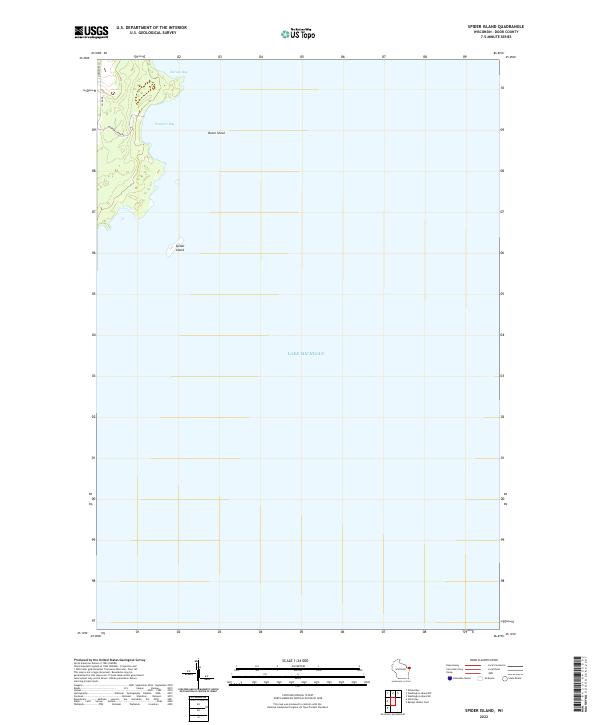
2022 Map of Spider Island
USGS Topo · Published 2022About this map
Spider Island and the coastal contours of Door County define this 2022 survey of the Lake Michigan shoreline. The map focuses on a transitional landscape where the land meets the water at Newport Bay and Europe Bay, illustrating the natural interface of the Wisconsin peninsula. Land access is restricted to a few routes like Newport Park Rd and Co Rd Np, which lead toward the shoreline and the secluded N Newport Ln. The offshore environment is marked by Outer Shoal, a feature critical for maritime navigation in these northern waters. This modern topographic record from the U.S. Geological Survey preserves the exact boundaries and hydrography of this protected coastal area, providing a precise spatial reference for the peninsula's northeastern edge.
Find a feature on this map
9 named features on this map. Tap any name to fly to it.
Don’t see what you’re looking for? This feature index may not catch every label — zoom into the map to look around manually.
Map Details
Editions of this 2022 Spider Island Map
This is the sole edition of this map. No revisions or reprints were ever made.
Other maps of this area

1954 · Escanaba
USGS Topo · 1:250,000

1957 · Escanaba
USGS Topo · 1:250,000

1958 · Escanaba
USGS Topo · 1:250,000

1960 · Washington Island
USGS Topo · 1:62,500

1960 · Sister Bay
USGS Topo · 1:62,500

1960 · Ellison Bay
USGS Topo · 1:62,500

1981 · Marinette
USGS Topo · 1:100,000

1982 · Washington Island SE
USGS Topo · 1:24,000
1982 · Ellison Bay
USGS Topo · 1:24,000
1982 · Baileys Harbor East
USGS Topo · 1:24,000