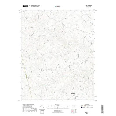
2019 Map of Spies
USGS Topo · Published 2019About this map
West Philadelphia and Spies anchor this rural landscape in the southern Piedmont, where the terrain is intricately carved by a dense network of tributaries. The hydrology of the region is defined by Bear Creek and its many feeders, including W Br Bear Cr and Williams Creek, alongside southern drainages like Cabin Creek and Wet Creek. These watercourses dictate the winding path of local roads, such as Browers Mill Rd, which likely traces its origins to early industrial water-power sites along the creek beds.
Find a feature on this map
103 named features on this map. Tap any name to fly to it.
Don’t see what you’re looking for? This feature index may not catch every label — zoom into the map to look around manually.
Map Details
Editions of this 2019 Spies Map
This is the sole edition of this map. No revisions or reprints were ever made.
Other maps of this area

1942 · Troy
USGS Topo · 1:125,000

1953 · Raleigh
USGS Topo · 1:250,000

1954 · Raleigh
USGS Topo · 1:250,000

1957 · Troy
USGS Topo · 1:62,500

1957 · Asheboro
USGS Topo · 1:62,500

1968 · Erect
USGS Topo · 1:24,000

1968 · Bennett
USGS Topo · 1:24,000

1973 · Seagrove
USGS Topo · 1:24,000

1974 · Candor
USGS Topo · 1:24,000
1977 · Robbins
USGS Topo · 1:24,000