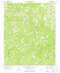
1977 Map of Spies
USGS Topo · Published 1978About this map
Bear Creek and its many tributaries, including Wolf Creek and Cabin Creek, dominate this rural landscape along the Montgomery and Moore county line. The Norfolk Southern railroad cuts an east-west path through the terrain, passing through the small community of Spies. This area in the late 1970s was defined by a dense network of country churches and family landmarks, such as Mt Zion Ch, Shamburger Cem, and Bascoms Chapel.
Find a feature on this map
31 named features on this map. Tap any name to fly to it.
Don’t see what you’re looking for? This feature index may not catch every label — zoom into the map to look around manually.
Map Details
Editions of this 1977 Spies Map
This is the sole edition of this map. No revisions or reprints were ever made.
Other maps of this area

1942 · Troy
USGS Topo · 1:125,000

1953 · Raleigh
USGS Topo · 1:250,000

1954 · Raleigh
USGS Topo · 1:250,000

1957 · Troy
USGS Topo · 1:62,500

1957 · Asheboro
USGS Topo · 1:62,500

1968 · Erect
USGS Topo · 1:24,000

1968 · Bennett
USGS Topo · 1:24,000

1973 · Seagrove
USGS Topo · 1:24,000

1974 · Candor
USGS Topo · 1:24,000
1977 · Robbins
USGS Topo · 1:24,000