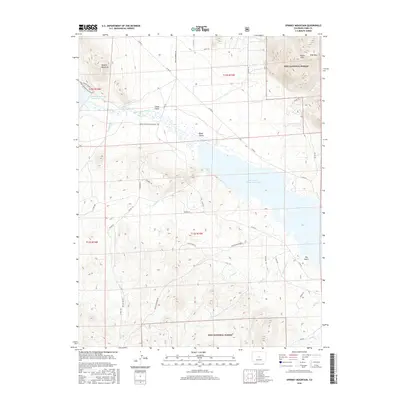
2016 Map of Spinney Mountain
USGS Topo · Published 2016About this map
The South Platte River winds through the high-altitude terrain of central Colorado, feeding into the major catchments of Spinney Mountain Reservoir and the expansive Elevenmile Canyon Reservoir. This landscape is defined by the sharp transition between the river valley and the surrounding peaks of the Puma Hills, where Stoll Mtn and Spinney Mountain overlook the basin. The area is heavily influenced by the managed waters of the South Platte, which are supported by numerous tributaries including Threemile Cr and Balm of Gilead Cr. Within the eastern portion of the map, the Pike National Forest boundary marks a shift toward more protected wilderness. The local road network, including the Aurora Private Rd and Spinney Mountain Access Rd, underscores the importance of water management and recreation in this part of Park County, while drainage features like Chase Gulch and Boyer Gulch illustrate the complex natural topography.
Find a feature on this map
41 named features on this map. Tap any name to fly to it.
Don’t see what you’re looking for? This feature index may not catch every label — zoom into the map to look around manually.
Map Details
Editions of this 2016 Spinney Mountain Map
This is the sole edition of this map. No revisions or reprints were ever made.
Other maps of this area

1893 · Platte Canyon
USGS Topo · 1:125,000

1894 · Pikes Peak
USGS Topo · 1:125,000

1901 · Pikes Peak
USGS Topo · 1:125,000

1953 · Denver
USGS Topo · 1:250,000

1954 · Pueblo
USGS Topo · 1:250,000

1956 · Tarryall
USGS Topo · 1:24,000

1956 · Sulphur Mountain
USGS Topo · 1:24,000

1956 · Elevenmile Canyon
USGS Topo · 1:24,000

1956 · Guffey NW
USGS Topo · 1:24,000

1956 · Glentivar
USGS Topo · 1:24,000