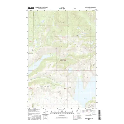
2017 Map of Spirit Lake West
USGS Topo · Published 2017About this map
Gifford Pinchot National Forest dominates this landscape, showing the dramatic topography of the Mount St. Helens area decades after the 1980 eruption. The recovery of the ecosystem is evident in the formation and boundaries of Coldwater Lake and the altered shoreline of Spirit Lake, where Bear Cove and Duck Bay are clearly delineated. The map highlights the high ridges that define the blast zone, including Johnston Ridge and Harrys Ridge, providing a detailed look at the drainage patterns of Coldwater Cr and the N Fork Toutle River. Smaller alpine bodies like Venus Lake, Island Lake, and Hanaford Lake remain nestled among peaks such as Minnie Peak and Mt Margaret. This survey serves as an essential record for those studying the geomorphic changes and the persistent geological features of this volcanic terrain, from the heights of The Dome to the depths of Tradedollar Lake.
Find a feature on this map
37 named features on this map. Tap any name to fly to it.
Don’t see what you’re looking for? This feature index may not catch every label — zoom into the map to look around manually.
Map Details
Editions of this 2017 Spirit Lake West Map
This is the sole edition of this map. No revisions or reprints were ever made.
Other maps of this area

1919 · Mount St Helens
USGS Topo · 1:125,000

1953 · Hoquiam
USGS Topo · 1:250,000

1953 · Cougar
USGS Topo · 1:62,500

1953 · Elk Rock
USGS Topo · 1:62,500

1957 · Hoquiam
USGS Topo · 1:250,000

1957 · Spirit Lake
USGS Topo · 1:62,500

1958 · Mt St. Helens
USGS Topo · 1:62,500

1958 · Hoquiam
USGS Topo · 1:250,000

1962 · Hoquiam
USGS Topo · 1:250,000
1975 · Mt. St. Helens NE
USGS Topo · 1:24,000