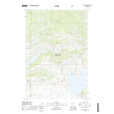
2020 Map of Spirit Lake West
USGS Topo · Published 2020About this map
Coldwater Lake and the surrounding drainage of the N Fork Toutle River dominate this modern survey of the Gifford Pinchot National Forest. This terrain is defined by its recovery and dramatic topography near the Skamania and Cowlitz county line. High-altitude landmarks like Coldwater Peak and Johnston Ridge offer a look at the volcanic landscape, while the presence of the Coldwater Trail indicates the recreational corridors established throughout the region.
Find a feature on this map
50 named features on this map. Tap any name to fly to it.
Don’t see what you’re looking for? This feature index may not catch every label — zoom into the map to look around manually.
Map Details
Editions of this 2020 Spirit Lake West Map
This is the sole edition of this map. No revisions or reprints were ever made.
Other maps of this area

1919 · Mount St Helens
USGS Topo · 1:125,000

1953 · Hoquiam
USGS Topo · 1:250,000

1953 · Cougar
USGS Topo · 1:62,500

1953 · Elk Rock
USGS Topo · 1:62,500

1957 · Hoquiam
USGS Topo · 1:250,000

1957 · Spirit Lake
USGS Topo · 1:62,500

1958 · Mt St. Helens
USGS Topo · 1:62,500

1958 · Hoquiam
USGS Topo · 1:250,000

1962 · Hoquiam
USGS Topo · 1:250,000
1975 · Mt. St. Helens NE
USGS Topo · 1:24,000