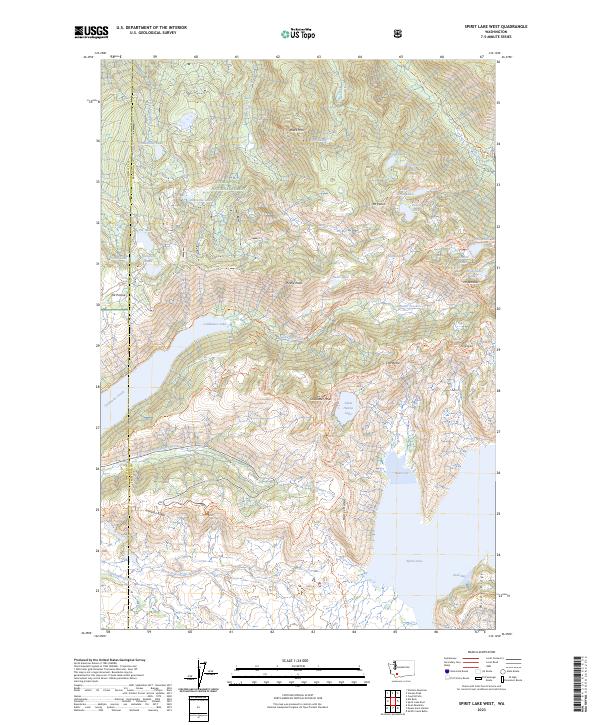
2023 Map of Spirit Lake West
USGS Topo · Published 2023About this map
The Mount Saint Helens National Volcanic Monument defines this landscape, showing the complex recovery of a terrain transformed by the 1980 eruption. This modern survey details a high-elevation alpine environment where the North Fork Toutle River and Studebaker Creek drain the western blast zone. Major water bodies like Coldwater Lake and the northern reaches of Spirit Lake are prominent, accompanied by the various lakes of the back-country including Venus Lake and Hanaford Lake. Significant ridges and overlooks used for volcanic observation and research, such as Johnston Ridge and Harrys Ridge, provide context for the dramatic topography. The map also traces a network of high-country routes like the Boundary Trl and Whittier Ridge Trl, crossing into the adjacent Gifford Pinchot National Forest.
Find a feature on this map
54 named features on this map. Tap any name to fly to it.
Don’t see what you’re looking for? This feature index may not catch every label — zoom into the map to look around manually.
Map Details
Editions of this 2023 Spirit Lake West Map
This is the sole edition of this map. No revisions or reprints were ever made.
Other maps of this area

1919 · Mount St Helens
USGS Topo · 1:125,000

1953 · Hoquiam
USGS Topo · 1:250,000

1953 · Cougar
USGS Topo · 1:62,500

1953 · Elk Rock
USGS Topo · 1:62,500

1957 · Hoquiam
USGS Topo · 1:250,000

1957 · Spirit Lake
USGS Topo · 1:62,500

1958 · Mt St. Helens
USGS Topo · 1:62,500

1958 · Hoquiam
USGS Topo · 1:250,000

1962 · Hoquiam
USGS Topo · 1:250,000

1975 · Mt. St. Helens NE
USGS Topo · 1:24,000