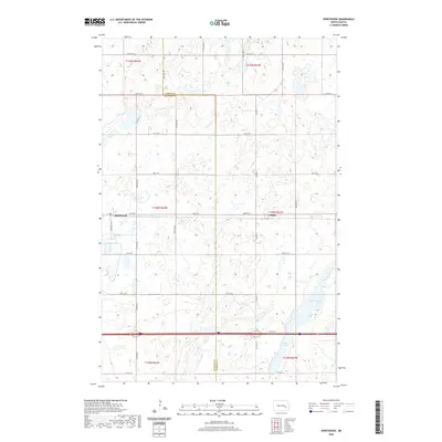
2020 Map of Spiritwood
USGS Topo · Published 2020About this map
Spiritwood and Urbana anchor this section of the prairie, where the border between Stutsman and Barnes Counties divides a landscape of glacial depressions and wetlands. The terrain is characterized by a high density of small water bodies and seasonal basins, with larger features like Island Lake, Goose Lake, and Rush Island Lake punctuating the eastern and western edges. A strict section-line road grid, including Airport Rd and Co Rd 40, defines the agricultural layout, reflecting the enduring legacy of the Public Land Survey System in this part of North Dakota. Modern infrastructure is represented by the heavy corridor of Interstate 94, which cuts across the southern portion of the map, contrasting with the quiet residential and grain-handling character of the local settlements.
Find a feature on this map
24 named features on this map. Tap any name to fly to it.
Don’t see what you’re looking for? This feature index may not catch every label — zoom into the map to look around manually.
Map Details
Editions of this 2020 Spiritwood Map
This is the sole edition of this map. No revisions or reprints were ever made.
Other maps of this area

1896 · Jamestown
USGS Topo · 1:125,000

1897 · Eckelson
USGS Topo · 1:125,000

1900 · Pingree
USGS Topo · 1:125,000

1951 · Spiritwood Lake
USGS Topo · 1:24,000

1952 · Ypsilanti
USGS Topo · 1:24,000

1952 · Bloom
USGS Topo · 1:24,000

1952 · New Rockford
USGS Topo · 1:250,000

1953 · Jamestown
USGS Topo · 1:250,000

1956 · New Rockford
USGS Topo · 1:250,000

1956 · Jamestown
USGS Topo · 1:250,000