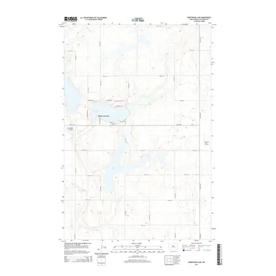
2014 Map of Spiritwood Lake
USGS Topo · Published 2014About this map
Spiritwood Lake anchors this part of Stutsman County, where the shoreline is defined by a dense network of local roads and recreational access points. The settlement of Spiritwood Lake occupies the southern and eastern banks, featuring a grid of named residential and access ways including Spiritwood Ave, Sandy Beach Rd, and Spirit Inn Rd. This concentration of development contrasts with the surrounding agricultural sections, which are partitioned by a rigorous township-and-range road system such as 20th St SE and 94th Ave SE. To the southwest, the terrain is marked by Sevenmile Coulee, while the far eastern edge of the survey area shows Mutschler Field Airport. The map captures a transition from rural prairie to a localized lakeside community, with specific points like Camp Rokiwan Rd and Game And Fish Rd suggesting the area's use for recreation and conservation.
Find a feature on this map
29 named features on this map. Tap any name to fly to it.
Don’t see what you’re looking for? This feature index may not catch every label — zoom into the map to look around manually.
Map Details
Editions of this 2014 Spiritwood Lake Map
This is the sole edition of this map. No revisions or reprints were ever made.
Other maps of this area

1896 · Jamestown
USGS Topo · 1:125,000

1897 · Eckelson
USGS Topo · 1:125,000

1900 · Pingree
USGS Topo · 1:125,000

1950 · Fried
USGS Topo · 1:24,000

1951 · Jamestown
USGS Topo · 1:24,000

1951 · Fried
USGS Topo · 1:24,000

1951 · Spiritwood Lake
USGS Topo · 1:24,000

1951 · Courtenay
USGS Topo · 1:24,000

1952 · Courtenay NW
USGS Topo · 1:24,000

1952 · Bloom
USGS Topo · 1:24,000