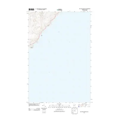
2013 Map of Split Rock Point NE
USGS Topo · Published 2013About this map
Split Rock Lighthouse stands as a sentinel on the North Shore, perched above the expansive waters of Lake Superior. This 2013 survey illustrates a rugged coastal stretch of Lake County where the topography rises sharply from the shoreline, reaching elevations over 1,300 feet within a short distance of the water. The corridor for MN-61 snakes along the bluff line, tracing the natural contour of the coast. Offshore, the small outcrop of Gull Rock is one of the few named terrain features in an area dominated by the interface of deep water and steep woodland. The map detail highlights the sparse infrastructure characteristic of this protected corridor, focusing on the preservation of the landmark lighthouse site and the essential highway link between coastal communities.
Find a feature on this map
4 named features on this map. Tap any name to fly to it.
Don’t see what you’re looking for? This feature index may not catch every label — zoom into the map to look around manually.
Map Details
Editions of this 2013 Split Rock Point NE Map
This is the sole edition of this map. No revisions or reprints were ever made.
Other maps of this area

1954 · Silver Bay
USGS Topo · 1:62,500

1954 · Two Harbors
USGS Topo · 1:250,000

1956 · Split Rock Point
USGS Topo · 1:24,000

1956 · Finland
USGS Topo · 1:62,500

1956 · Illgen City
USGS Topo · 1:24,000

1956 · Split Rock Point
USGS Topo · 1:62,500

1956 · Split Rock Point NE
USGS Topo · 1:24,000

1957 · Two Harbors
USGS Topo · 1:250,000

1958 · Two Harbors
USGS Topo · 1:250,000

1964 · Two Harbors
USGS Topo · 1:250,000