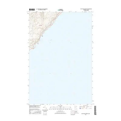
2016 Map of Split Rock Point NE
USGS Topo · Published 2016About this map
The North Shore of Lake Superior meets the densely contoured elevation of Lake County in this 2016 survey. The map highlights the sharp transition from the water's surface to the high ground of the Minnesota wilderness, specifically within township t55n r8w. Navigation and local access are defined by Pine Bay Loop, which winds through the interior hills above the shoreline. Key coastal features such as Islet Bay and Pine Bay provide natural indentations along the lakefront, while Gull Rock sits as a prominent landmark just offshore. The topography here is steep, illustrating the dramatic rise of the Sawtooth Mountains region from the lake's edge.
Find a feature on this map
6 named features on this map. Tap any name to fly to it.
Don’t see what you’re looking for? This feature index may not catch every label — zoom into the map to look around manually.
Map Details
Editions of this 2016 Split Rock Point NE Map
This is the sole edition of this map. No revisions or reprints were ever made.
Other maps of this area

1954 · Silver Bay
USGS Topo · 1:62,500

1954 · Two Harbors
USGS Topo · 1:250,000

1956 · Split Rock Point
USGS Topo · 1:24,000

1956 · Finland
USGS Topo · 1:62,500

1956 · Illgen City
USGS Topo · 1:24,000

1956 · Split Rock Point
USGS Topo · 1:62,500

1956 · Split Rock Point NE
USGS Topo · 1:24,000

1957 · Two Harbors
USGS Topo · 1:250,000

1958 · Two Harbors
USGS Topo · 1:250,000

1964 · Two Harbors
USGS Topo · 1:250,000